Showing posts with label Matheran. Show all posts

Thursday, June 15, 2023

Garbett Plateau Trek, Neral, Matheran

Garbett Plateau is a vast plateau which is elongated in shape. This plateau is very long and distinct. It can be seen from anywhere from Matheran view points. This plateau has one village amidst the jungles. From this village people come up to Matheran to do business. Garbett has a view point upto which it can be hiked or trekked. From the Garbett view point one can see whole of Garbett plateau till the end.

There are 2 ways to reach the Garbett plateau

1) Either from Matheran (Dasturi Naka) which is a hike walk amidst the jungles. (SHORT WAY) 2.5-3km

2) Trek from Diksal village which is at the base (LONG WAY) 9km

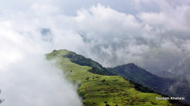
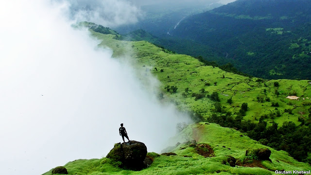
Garbett plateau is known for its green pastures and unique beauty in which it is mostly covered in clouds during monsoon. One side is full of clouds and other side is full clean especially a phenomenon seen during monsoon season.

One can also see many waterfalls, lakes, pastures and dam along the way to Garbett plateau. Garbett plateau overall length is around 2km long and around 50m and its thinnest width. Garbett Plateau elevation is around 550m to 600m above sea level whereas its Garbett viewpoint which is at top is around 730m above sea level.

Garbett Plateau Trek, Neral, Matheran

How to reach Garbett Plateau?

ROUTE 1: HIKE from Dasturi naka in Matheran

There is a route which goes to Garbett Plateau view point from Matheran. There are well marked boards to Garbett point. Usually horses do not go to this point as at places the route is washed and narrow. This is more sort of a hike or walk amidst the jungles. This point is best when walked. Most of the people take this route as it does not involve trekking. It is a straightforward route to the view point and takes less time. It is around 2.5km oneway walk from the Matheran rail tracks to the point.

This walk is the most beautiful in Matheran as it is untouched and the jungles are calm serene with winds blowing by. Mist all over the forest and dense jungles are beautiful here.

Garbett Plateau Trek, Neral, Matheran

The point area above is quite big but since it is occupied and climbed by only trekkers you wont find any refreshment stalls here. This is the beauty of this point. The point offers all 270 view of Garbett Plateau. The point is barricaded like other Matheran points and safety is there.

Garbett Plateau Trek, Neral, Matheran

Garbett Plateau Trek, Neral, Matheran

Garbett Plateau village was once a British village with and the plateau was famous for the quartz crystal which was found abundant and scattered all over the plateau. Now it is a vast grazing pastures for the animals cattles and goats. Another route goes down from the Garbett plateau to a village called Sagachiwadi which is the second base village of Garbett while climbing from Diksal village.

Garbett Plateau Trek, Neral, Matheran
Cattles grazing on Garbett Plateau
Garbett Plateau Trek, Neral, Matheran
Staring at the sea of clouds from Garbett Plateau
Garbett Plateau Trek, Neral, Matheran
Climbing up to the Garbett Point from Garbett Plateau
Garbett Plateau Trek, Neral, Matheran
Climbing up to the Garbett Point from Garbett Plateau
Garbett Plateau Trek, Neral, Matheran

Garbett Plateau Trek, Neral, Matheran

ROUTE 2: Trek from Diksal Village via Sagachiwadi village and Dhom dam

The full trek from the base Diksal (konkan) till the top is very long and quite an endurance is required.

The total distance of the trek from the base of mountain Diksal is as follows:

1) Diksal village to Garbett Plateau entry - 4.5km

2) Garbett Plateau Entry to Garbett view point - 2km

3) Garbett view point to Matheran tracks - 2.5km

It takes a trek of total 9km right from Diksal village, Neral to Matheran


The route starts from Diksal village. The route shown in above map is the most common one which almost every trekker takes. However there are multiple ways to reach Sagachiwadi as well as there are multiple ways to reach the spur walk from Sagachiwadi as the area is wide open.
The trek route is pretty straightforward. One has to just keep climbing and walking for a total of 9km to reach Matheran tracks or 6.5km till the Garbett view point. It takes quite an endurance and time around 3 to 4 hours casually.

Garbett Plateau Trek, Neral, Matheran

Garbett Plateau Trek, Neral, Matheran

Garbett Plateau Trek, Neral, Matheran

Garbett Plateau Trek, Neral, Matheran

The view from Garbett plateau is excellent and picturesque. Though being close to Matheran Garbett plateau seems out like it is from a different world with utmost peace and tranquil.

Garbett was usually called as Gharbut as its name is local. Gars means quartz in marathi hence this plateau was abundant in Quartz or Gars getting its name as Garbut or later Garbett Plateau. The uniqueness is that there is only one side of the valley densly covered in fog whereas the other side of the valley remains clean most of the time giving it a distinct feature in monsoon.

Garbett Plateau Trek, Neral, Matheran

Garbett Plateau Trek, Neral, Matheran

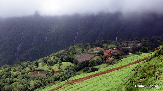
Garbett village is a group of villages which is away from market and situated on the valley shadow of Garbett hill. The village has rock cuts steps to go down which is mostly weathered out and used by the locals to come up to Matheran to do business. The village is unique as it stands since ancient times.
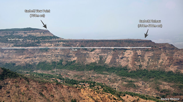
Garbett Plateau Trek, Neral, Matheran
This Garbett village is no less than a village from swiss alps. The location of the village is very beautiful.
Garbett Plateau Trek, Neral, Matheran

Garbett Plateau Trek, Neral, Matheran

Garbett Plateau Trek, Neral, Matheran


One can even enjoy DIKSAL WATERFALL enroute


Thursday, April 21, 2022

Dhodani Waterfalls, Panvel, Maharashtra (Dodhani)

Dhodani or Dodhani (धोदाणी ) is a village which lies at the base of Matheran mountain range. This village lies at the west end of Matheran mountain. This is by far the best located village at the base of Matheran mountain. Dhodani is also well connected by local bus starting from Panvel station. This is a fairly big village. However this village is surrounded by numerous rivers which gets collected into Gadeshwar dam. Yet another scenic place near Dhodani. The main waterfall here which is most visited is the Dhodani or Dodhani Waterfalls. However the lower end of the falls is known as Sukha waterfalls. Being easily accessible and nearby along with being beautiful many tourist as well as trekkers come here during monsoon. The waterfall is very safe with no pools.


GADESHWAR DAM LAKE

Many trekkers also trek to Matheran from Dhodani village. The Matheran is accessible from all sides and Dhodani is one of them. The route from this village opens up in Sunset or Porcupine point at the top of Matheran. An easy level trek.

The overall Dhodani is broken into steps and fall height is appx over 200 to 250m. The main stage is very big and cataract where as the lower end (Sukha) is a type of cascade and very beautiful.

Main Dhodani Cataract Falls

Dhodani or Dodhani can be visited in monsoon. Local villagers are very helpful and also provide food and refreshments to tourists. However it should be the duty of visitors to keep such nature places clean and green. No littering in such places as well as no drinking. The peace of such places should be maintained.

The river is the prime source of the villagers for irrigation, farming as well as house hold activities. Tremendous volume of water flows through this river during monsoon. The river bed is very wide. One can even enjoy near the river beds.

DHODANI WATERFALLS

DHODANI WATERFALLS

Also certain groups perform rappelling over these falls along with ziplining. A perfect waterfall to perform waterfall rappelling.
Sukha Dhodani Waterfall Top

However the top part of waterfall is quite dangerous. The rocks are very slippery and the curvature is smooth. As well as there is a small hole in rock which is deep and can form whirpools during heavy flow. Height of the falls is around 30m ideal for rappelling and lies at an altitude of 230m above sea level. However the main falls drop from Matheran plateau around 650m above sea level from Simpson Tank in Matheran.


Dhodani is by far the most beautiful waterfall in Panvel region near Matheran. It can be visited by all of any age group. It is easily accessible from village as well as village is well connected with roads by transports.

HOW TO REACH

1. Panvel to Dhodani ST buses
2. Local jeeps
3. Private transport
4. Road route starts from Terana Circle in New Panvel East which passes straight through Koproli and Nere Gaon going straight towards Maldunge Dhodani village via Gadeshwar Dam. (20km from Panvel Rail Station)
5. Parking is also available at the village near Temple. (5 to 7 four wheelers vehicles max)

DHODANI WATERFALLS MAP TREK ROUTE


One can also spend some time on vast meadows of Dhodani village which provides good range views of Matheran and surrounding mountains.


Wednesday, December 22, 2021

Dhangar Waterfall, Kondeshwar, Badlapur, Maharashtra

Dhangar Waterfall lies in Badlapur region near Kondeshwar village along side Bhoj Dam. Dhangar waterfall is a beautiful located waterfall lying in ranges of Matheran. This waterfall is easily accessible from multiple ways. This waterfall is around 25 to 30m in height.

This waterfall is very dangerous during heavy flows as a heavy volume of water flows through it. This waterfall should be avoided during heavy rains. There are two small ponds right at the base of the falls which are deep enough if not taken care. The waterfall is remote and beautifully located. During heavy rains this place is closed by local police.

The water flows in a single column if there is good amount of water. As flow of water decreases the column splits into giving it more beautiful look. Waterfall top can be accessed easily. 

It is not advised to swim in the waters at the pool of this waterfall without judging the depth of pool.


How to Reach:

Waterfall is accessible from two ways, either a walk from the Bendshil village or can be accessed directly from top of falls via a rough road. The road till Bendshil is fair and parking also food stall available at village. The other road which goes till top of waterfall is poor. Two wheelers can ply easily. Four wheelers will need to go rough. For map route trek refer below.


Dhangar Waterfall Drone Video


Some pictures of the Dhangar Falls


Monday, November 15, 2021

Diksal Waterfall, Bhivpuri Rd, Karjat, Maharashtra

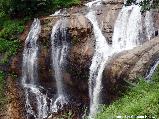
Diksal waterfall lies in Bhivpuri region of Karjat. This waterfall is appx 35m in height with a convex surface ideal for rappelling activities. This has its source from Matheran range of Garbett and Sondai. Its mouth is at Dhom Dam. This is indeed a beautiful waterfall which is accessible from Diksal base village which is also the base village for Garbett Plateau trek. The waterfall is surrounded by various mountains from all side of Matheran range. The way to reach waterfall is a 2km walk from base village alongside Dhom Dam. The place is extremely beautiful with vast stretches of water of Dhom Dam. 


Waterfall is easy to reach and no hard or risky trekking is required. The route is picturesque and refreshing with Matheran range clearly visible.


The route passes from the left side of the dam. However during cloudburst the route can be dangerous. The dam is not meant for swimming. Recently a certain group of boys had drowned. Entering dam waters is strictly prohibited. While going to waterfall one can encounter many paddy fields.


Also a huge landslide has also taken place aside the dam as seen in above picture. A huge chunk of mass of land has spilled all the way down.


One can even enjoy the dam aside. One can avoid waterfall and enjoy the banks aside the dam. 


One can even go on top of waterfall. The top part of waterfall is very slippery and should not go till the end of falls. Waterfalls are dangerous when there is flash floods. There is not much pool depth of Diksal and waterfall is safe as long as there is no cloudburst.

The walk from base village Diksal is around 2km. The base village is also at a walkable distance from Bhivpuri Rd Railway Station. The local villagers are friendly. There is not much space for 4 wheeler parking at base. 2 Wheelers can manage though. During heavy rains there may be police duty rounds.

OVERALL SUMMARY:

  • Easily Accessible
  • Low Cardio
  • Less Parking Space
  • One can continue to Garbett Plateau
  • Not to enter dam waters
  • No confusing routes
  • Beautiful and Scenic location

MAP ROUTE FOR DIKSAL WATERFALL:


DIKSAL WATERFALL VIDEO