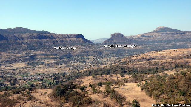
Sindola or Shindola fort is a small hill fort in Junnar region of Maharashtra on top of Malshej Ghat Plateau. Sindola mountain is distinct by its pinnacle structure visible from anywhere. Sindola is more of a sort of military base as it offers whole view of Malshej and Pargaon region and all of its neighboring forts. Sindola dates back very old at the similar times of Nimgiri and Hadsar.
The start of Sindola fort is from Karanjale village which is one of the 3 base villages of Sindola. Other being Bagadwadi at Pargaon and other Velkhind which connects Malshej to Pargaon region. The route starts from the fields opposite the signboard of Karanjale village from the fields. The route is not marked but is quite distinct as one has to go up and reach Sindola plateau at the start point of the ridge. Route is quite distinct and less chance of losing the way.
Climb to the ridge can be started from any side but one will have to go through dense bushes. The easiest way to climb is to head for the start of the ridge which has no dense bushes. One can see whole neighbouring region of Sindola while climbing the ridge.
After climbing the ridge one will reach the spot of Sindola pinnacle. After this the route traverses towards the left side and reaches a gully from where one has to climb up through rock cut steps at certain intervals.
Pimpalgaon Jog Dam can be seen clearly.
There are 7 water cisterns carved into the rock.
MTDC resort of Malshej can be seen clearly from Sindola.
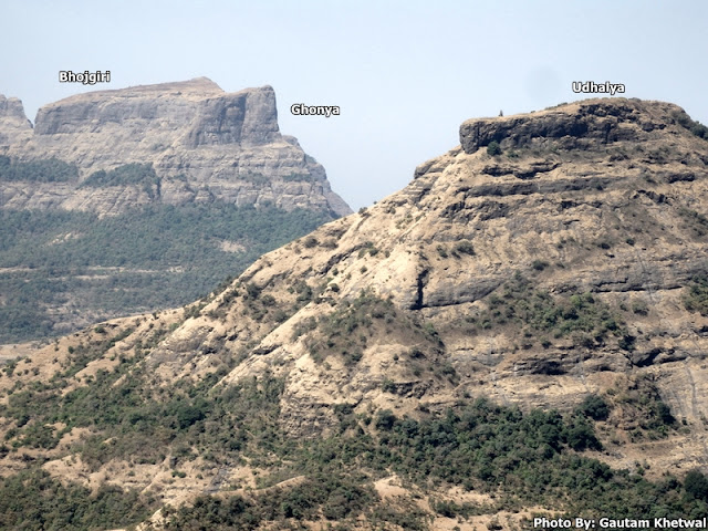
Bhairavnath mandir as seen in opposite mountain of Sindola on Udhalya hill.
Route to Sindola is pretty straight forward, easy to moderate climb (monsoon) and requires 2.5 km trek with an altitude gain of appx 450m where as overall height of mountain is around 1150m asl.
Sindola Fort Trek Map Route
Summary


No comments:
Post a Comment